Showing posts with label Road Travel. Show all posts

Thursday, July 3, 2014

Antioquia

Continuing on our road trip up the Lurín valley from Cieneguilla, we headed into Huarochirí province and to the town of Espíritu Santo de Antioquía, more commonly known as just Antioquía.

Antioquia's main square


Antioquia city hall
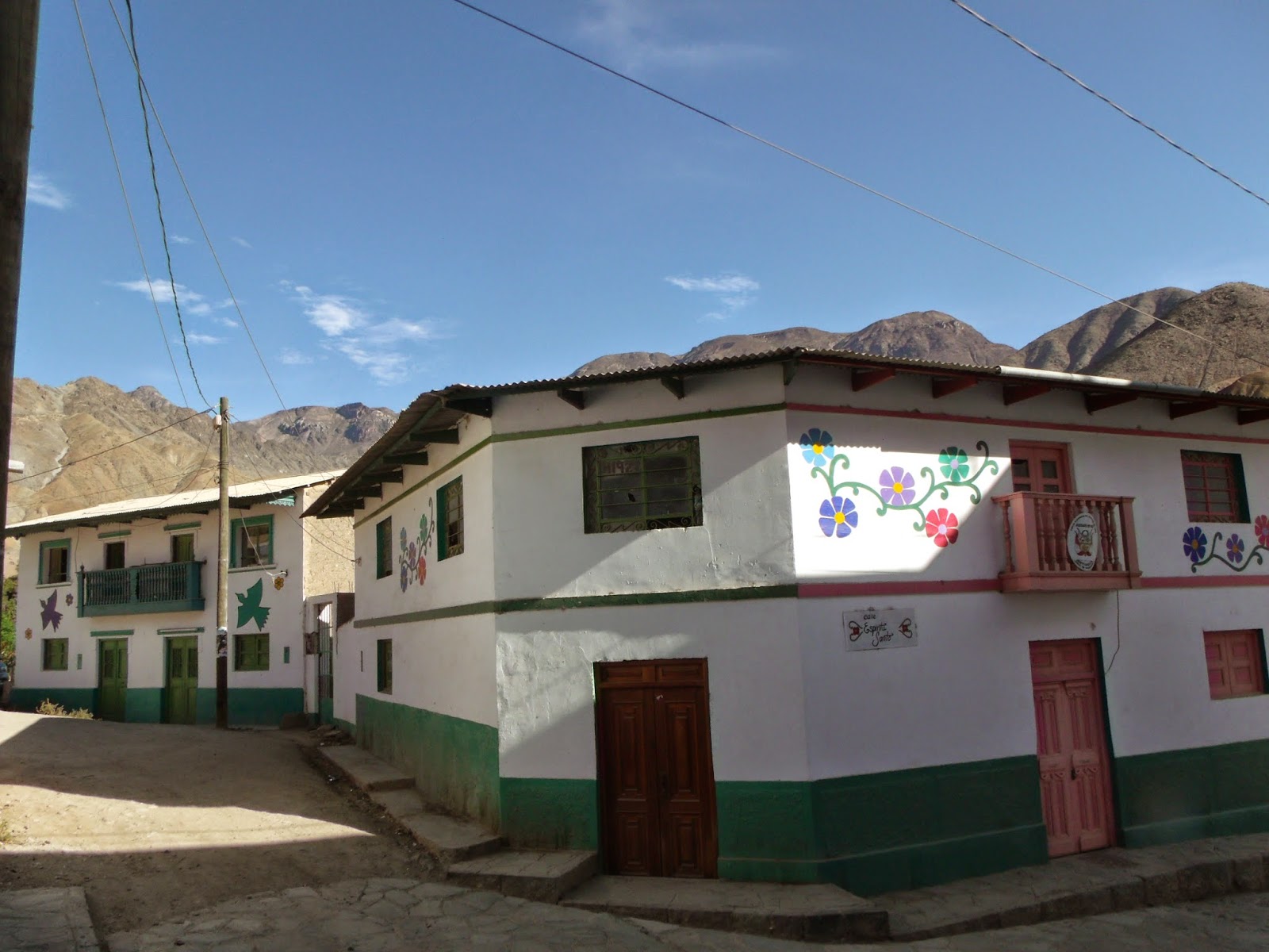
Antioquía's claim to fame is recent, and due to the townfolk's practice of decorating their homes with images drawn from nature - birds, plants, flowers.  The paintings, done in a naïf style, were the idea of a priest assigned to the town, who convinced the locals a few years ago to buy into the idea as a means of building town pride and pulling in a bit of the valley's tourist trade.  

Elba, Willy, and Liz in front of Antioquia's church

It must be admitted that the idea has on fact worked.  We, for example, were the third delegation from our family to make the trip to the town in the past several months, and we had all learned about it from it's being featured in newspaper, magazine, and television segments.


The road to Antioquía is still a bit rough, but even so there's enough traffic to allow a couple of restaurants with large seating to operate in town.   I expect that once the road is paved the whole way, it won't be long before a good segment of Cieneguilla's weekend tourist traffic will head that way, even though it is about an hour further, much as the summer beach exodus has moved ever further out of the city in the past decade.

u

Lunch on a Stone Table

Yesterday Liz and I headed out with Willy and Elba on a day trip to the Lurín Valley, which lies just over the hill from the bulk of the Lima metropolitan area. In fact, the valley's Cieneguilla area is the only district in the metro area that is not completely urbanized, and some farming and open areas are still to be found there.


Cieneguilla is a favored weekend get-away destination for limeños -such as our party- wishing to get away from the city's hustle-and-bustle and in search for a bit of country atmosphere.  Though our destination was further up the valley, in the nearby province of Huarichirí, we decided to make a stop in Cieneguilla for lunch.

We chose to eat at a restaurant called Mesa de Piedra, which means "stone table", in reference to the tables being made from large stone slabs gathered from the surrounding hillsides.


Mesa de Piedra holds some memories for us, as it was the locale for one our first large family gatherings, one of our last while Mama Pali was still alive, and one of the few that pulled in even some our more geographically remote cousins.

Fried crayfish, with toasted corn
Grilled guinea pig

Grilled rabbit
Our meal was quite good, and very pleasant in the country quiet, surrounded by birdsong (mercifully, the restaurant staff had not turned on any music).


Thus fortified, we were ready to continue on our journey....

Tuesday, October 4, 2011

Colca 5: Santa Ana de Maca

On the way back to Arequipa from Cabanaconde and Cruz del Condor on July 30th, our driver had us stop at the town of Santa Ana de Maca, whose main attractions are a small church and photo opportunities offered by enterprising locals.

Maca, located at 3262 meters (10,702 feet) above sea level, is a small town at the foot of Sabancaya volcano.  In 1609 it was made the seat of the colonial bishopric of the region.  Today the town lives from farming and a small share of the tourist economy.

The church was built in the 1600s, out of sillar, the white volcanic stone that is characteristic of the region's architecture.   It was rebuilt after it was partially destroyed by a fire in 1759.  

When we arrived there was a mass going on, and although we were not prohibited from entering, I hung back by the entrance for a bit.  I was able to catch enough of the mass to realize that it was a misa de cuerpo ausente, a funerary mass marking an anniversary -likely one month- of someone's death.  I chose then to exit and return later.

Outside, however, I was annoyed at a gaggle of European tourists who hung about snapping pictures of the parishioners and mourners as they left, particularly of the women dressed in the colorful traditional attire.  I did realize that they had no idea of the solemnity of the occasion, nor were they dissuaded by their own guide, but it still bugged me.


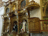
The inside of the church itself is relatively ornate in contrast to the outside, but still less so than so many other baroque churches in Peru.  It reflected a small town's best attempts, and evoked a prosperity long gone.

On each side of the nave there were effigies of saints, including a saint (Santa Ana?) in local attire and a 17th Century life-sized Christ the Nazarene.  There are also paintings of the Cusqueno school and plenty of gold leaf.

To the left of the altar, in a side nave, there were stored the andas, or litters, upon which the effigies are carried in procession through the town on their holy days.  Also kept there was rather detailed, life-sized effigy of the dead Jesus in a glass coffin, no doubt for the Easter Friday procession.


Being at the foot of the volcano and near a geological fault that transects the valley, the church of Maca has suffered damage throughout the centuries.  Fortunately it was declared a national treasure in 1980 and has been restored and maintained through funding provided by the Spanish crown.

Next to the church a couple of locals had trained eagles to stand upon tourists' arms, knees, shoulders, or heads. He requested a donation for letting one take pictures with the birds, and no doubt garnered far more that way than if he had requested a set amount.


The birds themselves were quite handsome and surprisingly heavy, as well as patient.

After a few minutes of this we reboarded the bus and continued our way back to Arequipa.

Friday, August 19, 2011

Colca 2: Choquetico

On the 29th of July the eleven of us, plus my infant niece, who had traveled to Arequipa ventured into the Colca Valley.   We had hired a van to take us to the town of Cabanaconde and back to Arequipa on the following day.   After passing through the Salinas y Aguada Blanca National Reserve, over the high puna at Patapampa, and through the mountain passes, we descended into the valley near the town of Chivay.  After lunch in Chivay we headed down the Colca Valley toward the canyon carved by the Colca River and toward Cabanaconde.

One of the sightseeing stops along the way was at a locale called Choquetico, near the town of Pinchollo.  The attraction of the stop at Choquetico -which is simply a stop at the shoulder of the road and a peek over the edge of the cliff- is a pair of carved boulders.


Choquetico is something I had not know about until I noticed what looked like a representation of a carved boulder on a model of the Colca Valley in Arequipa's Museo Santuarios Andinos.  My interest piqued, I made sure to ask our driver about it and was pleased to confirm that indeed we would be stopping there.

The reason for my excitement was that what I expected to see, and indeed did see, was an ancient carved boulder made to resemble the terracing on the slopes opposite, on the other side of the river, or at least what they looked like in pre-Inca times.


There are a few similar image stones scattered throughout the Peruvian Andes, perhaps most famously at Saywite.  They were apparently instrumental in fertility or rain ceremonies directed at the earth.   

If one looks at the photos one will notice the presence of a well atop each stone, with channels leading from it.   It seems that chicha or llama blood were poured into the well until it ran down the channel to the terraces carved into the stone, as water from the mountains above would flow down the slopes to water the agricultural terraces.  In "watering" the stone's terraces the priests thus symbolically watered the valley's slopes.


Overlooking the site are a pair of tombs placed high up on a cliff.   They would be nearly invisible but for the red paint applied by the ancients - in the Andes red was a color assiciated with nobility (the Inca royal "crown", for example, was a red tassel at the forehead).  Bothe tombs were sacked long ago, but their presence underscores the sacred nature and ritual nature of the site to the ancient Collaguas -as the people who inhabited the valley before the Incas arrived were known.

Wednesday, August 17, 2011

Colca


After about three hours on the road, we suddenly descended from the heights of Patapampa into the Colca Valley, near the town of Chivay.  Chivay, at the eastern, and upriver, end of the valley, is the economic and administrative hub of the area.  There, one must buy a Colca "Tourism Ticket".


That seems like a bit of an imposition, since one is simply paying to enter the valley, and the roads are public after all, but the regional government has allowed the Colca communities a certain autonomy in running local affairs and permitted them to impose that fee on tourists, so it is as it is.


Near Chivay

At this point, the Colca Valley is just that, a valley. It's a highly agricultural area, and nearly every available hillside is covered in agricultural terracing, some predating even the Inca presence in the valley.


Near Pinchullo

It isn't until near the town of Pinchullo that the river has carved out its famous canyon.   By then -shortly outside of Chivay, in fact- the road asphalt runs out and the road turns to one of packed-earth, until it nears Cabanaconde, our destination at the other end of the canyon.    At this time of year -winter, and the dry season- the road was bumpy, dusty, and slow, but traversable.  I'd hate to imagine what it woud be like at the height of the rains in January or February!


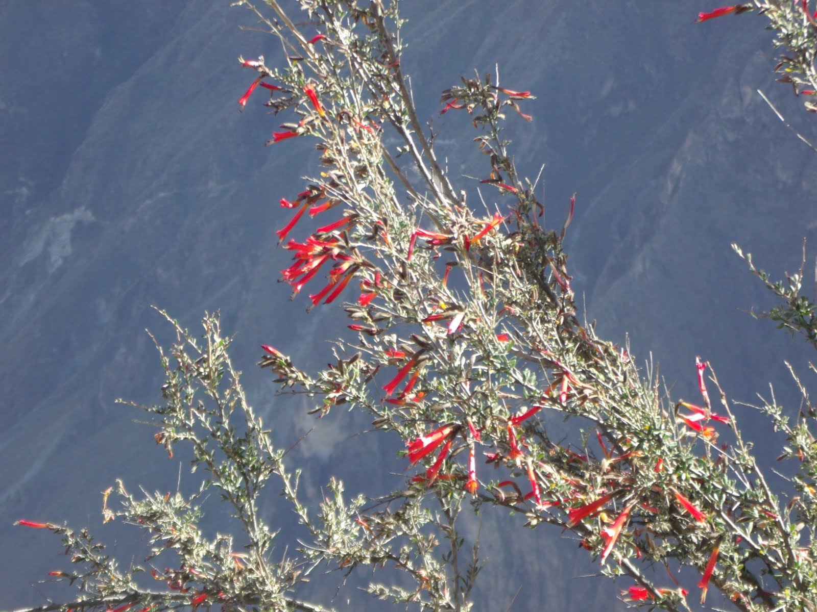
Cantuta blossoms.  Peru's national flower.

Near Cruz del Condor

At Cruz del Condor

Tuesday, August 16, 2011

Salinas y Aguada Blanca National Reserve


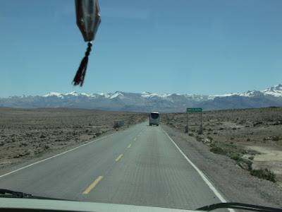
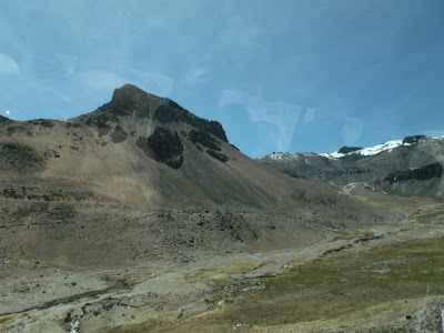
To get from Arequipa to the Colca Valley one leaves the city and skirts around Chachani volcano, following the Arequipa-Juliaca highway, and then takes the turn-off toward Colca.  On the way to Colca one must cross the Salinas y Aguada Blanca National Reserve.

The reserve encompasses 366,936 hectares and contains a number of fresh- and salt-water lakes and ponds -for which it is named- plus bogs and other high-altitude wetlands, as well as dry puna, volanic deposits, and snow-capped volcanoes. It was created in 1979 in order to protect the fauna, flora, and natural landscape of the area, and in particular to preserve habitat for vicuñas and guanacos - wild relatives of the domesticated llamas and alpacas.


The average elevation is above 4,000 meters a.s.l. - for example, at one spot where we stopped for a break the elevation was 4,225 m. (13,861 ft. a.s.l.), and at the Mirador de los Volcanes the road passes 4,910 m. (16,108 ft. a.s.l.).  Having been in Arequipa for a couple of days already seemed to have helped a bit with the altitude.


ICEFALL


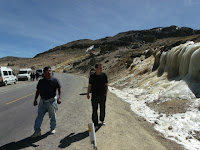
At one point along the way the road passes through the blown-out caldera of an extinct volcano.  While that's pretty impressive in itself, it is made even neater by a rather large icefall beside the road.


VICUÑAS


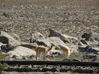
For the visitor, even ones just passing through, one of the primary attraction of the national reserve of Salinas y Aguada Blanca is the chance to see some wild vicuñas.

The vicuña is a wild cousin of the llama and the alpaca, and is one of two nondomesticated South American camelids - the other being the guanaco, which also inhabits the reserve but is rarely seen.  Vicuñas wool is among the finest in the world, and a garment made from it can easily fetch (US)$1000 or more.  The vicuña population in Salinas y Aguada Blanca is managed by the peasant communities within the reserve, who annually gather the animals for shearing, and patrol the reserve against poachers the rest of the year.

We were lucky enough to spot vicuñas both, on the way to, as on the way from, Colca.


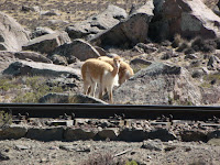
 Vicuñas live in small herds of one male and a handful of females.  Young males are kicked out of the herd, and wander for a while, until they establish herds of their own or they are strong enough to chase off another male and take over his harem.


Which means that this individual was likely a male a year-old or thereabouts.


VIZCACHAS

Another animal which occurs at those altitude, and which is normally quite shy as well, is the vizcacha.  Being usually described as similar in appearance to a rabbit, but really being much more like a chinchilla, vizcachas nest in crevices and spaces in between and under rocks throughout the Peruvian Andes.   They are sometimes hunted for their pelts and for food.

We were lucky, on our way back to Arequipa, to catch some sunning themselves on the rocks piles that had been left from clearing the roadbed through the Patapampa plateau, at above 4,800 meters a.s.l. (15,750 ft.).